 |
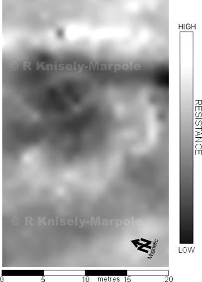
At the Gyrn, which overlooks Lake Bala to the north, the road changes direction at a point adjacent to a stony mound. We wondered whether this could be a signal station, as it was in the ideal place. We carried out a res survey of the mound and the path of the road. While the road shows well (the lighter area across the top of the plot) as does the west ditch (the darker stripe) the mound was inconclusive. Only excavation would give us the definitive answer. A very
wintery Easter week in 1999 found us putting a trench across the road and into the mound. The road surface and ditch were confirmed, but the mound turned out to be a barrow, or burial site, of which there were three others recorded in the immediate vicinity. Originally covered with local white quartz, they would have been prominent features, but as we found in our excavation, the Romans had stripped the brilliant white quartz stones to use as kerbs on their road!
Surveyed at 1 metre intervals. |