|
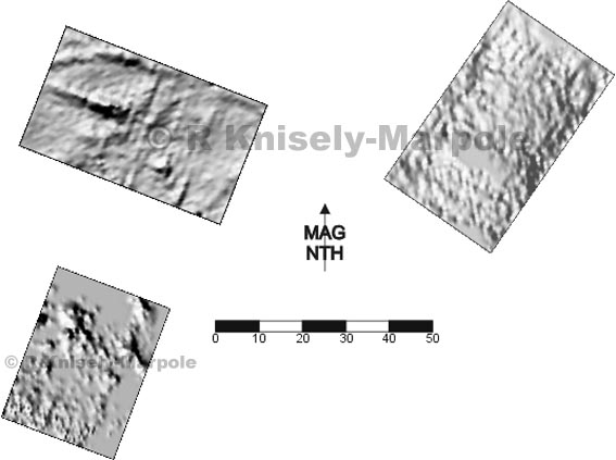
As a result of
a request from the owners of this site, we have carried out surveys on three
areas. The first, at bottom left, is a moated site, which is assumed to be the
original position of Hulland Old Hall. The geophys shows a number of rectangular
features and a clear line which looks as if it comes from the probable causeway
over the moat.
Above this, to the north are several platforms in the gently sloping ground,
where there is supposed to be the site of a chapel. So far, the geophys has
turned up some field drains and, more interestingly, a number of curving
features and we want to extend the area of survey to see what these are a part
of.
To the east, an AP shows an outline of a feature. The geophys of this shows what
looks like an enclosure with sub-divisions inside. This could be a walled
dwelling with courtyard or some sort of animal pen. There is a lot more work to
do on this site!
This is a scheduled site (NMR No: 13290), and a licence was required to carry
out the survey.
Surveyed at 1 metre intervals.
|